How Steve Jobs changed modern location intelligence
Retail chains that are benefiting from the tech revolution sweeping through the location intelligence industry owe a big thank you to Steve Jobs. Smartphones that millions of people now carry with them everywhere are allowing retail brands to capture more data and insights on consumer behavior and travel patterns than ever before.

Then vs Now
- Pre-iPhone era: Chains relied on zip codes obtained at POS to help define trade areas. Where did people live, and how far were they travelling to stores to make a purchase?
- Smartphone era: Mobile location technologies track movement at a more granular level. Where are consumers stopping before and after visiting a store? How are consumers moving within trade areas?
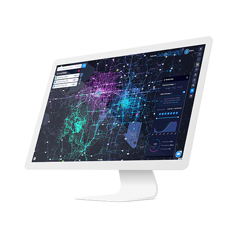
SiteZeus has partnered with leading mobile data source UberMedia to bring more customer data to its location intelligence platforms. UberMedia draws a virtual boundary or “GeoFence” around a particular location. For every smartphone that enters that GeoFence, such as the four walls of a store, UberMedia can track that smartphone for up to two hours before and two hours after entering.
Instead of looking at customers through an outdated lens based on where they live or where they work, the UberMedia model harnesses the latest technology to follow the path a customer traveled to get to that store. Did they stop at the gym, coffee shop or grocery store before or after? Where are customers going and what are they doing, and more importantly, what can that customer behavior tell you about your location decisions?
Throwing out outdated methods
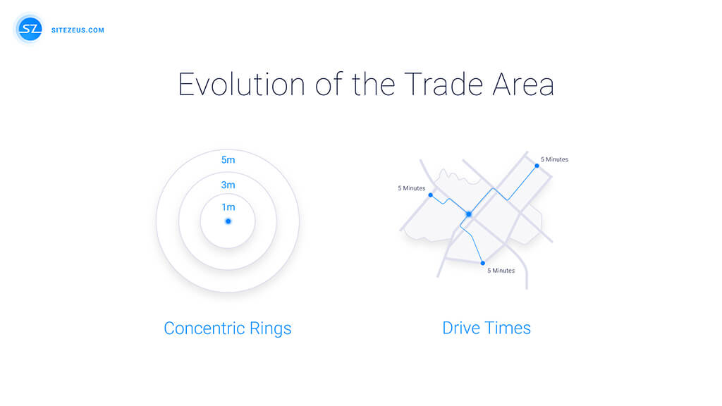
The pre-iPhone era defined trade areas by drawing concentric circles around a potential site and then looking at traffic and population counts within a 1, 3, or 5-mile radius. This is the methodology being used by the U.S. Census Bureau and Pitney Bowes. The inherent flaw in that system is that just because someone travels into a trade area doesn’t mean they have any interest in buying your products or services. Smartphone era data providers instead, tap into a smartphone’s activated location settings to track actual customer movement.

Traditional methods of identifying trade areas
Following mobile footsteps
Rather than making generalizations on the people in a trade area, similar to what the ClaritasPrizm model does, UberMedia is looking at an actual view of consumers and their behavior within a specific trade area. Leveraging geofencing technologies helps to deliver three key advantages:
- It’s more cost effective: Chains no longer need to spend time and money to conduct surveys to better understand customers.
- It requires less effort: Modern solutions leverage the power of artificial intelligence (A.I.) to do the calculations and correlate it to the desired functions of understanding customers’ path to purchase, defining the true trade area and determining peak traffic times.
- More comprehensive and contextual: Brands can now use mobile GPS data to understand what route a customer took to get to a store, what other stops did they make, and perhaps why they might pick one location over another?
How you identify and determine viability of trade areas can make or break your business when it comes to managing existing stores and planning new store growth. The basic prime behind location intelligence strategy is to better understand where to find core customers. Mobile technology and geofencing is revolutionizing location intelligence by replacing guesswork with precise data and analytics. Brands can make better location decisions by literally following the footsteps their customers take within a given trade area.
Modern way of identifying True Trade Area
Recommended Posts

